Mayan Ruins Seen From Space

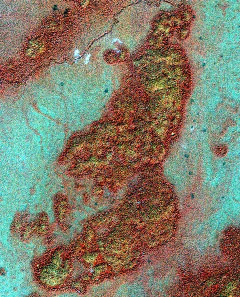
A false-color image of a Guatemalan bajo taken by the IKONOS satellite. Yellow splotches indicate areas that led scientists to Mayan ruins.
Image Credit: NASA/Space Imaging Inc.
When searching for ruins from ancient societies, such as the Maya, traveling by foot can be slow and dangerous. On top of that, trees and brush can obscure ruins from archaeologists.
That's partly why scientists turned to satellites to help uncover these remnants of ancient cultures. Because Mayans used limestone to build settlements, the crumbling ruins prevented several plant species from growing in areas around ruins. Satellites can detect these vegetation changes and help pinpoint the ruins.
Yellowish areas in the image above indicate such areas, and scientists found new ruins after traveling on the ground to satellite-guided areas. NASA scientists teamed up with an archaeologist for this research and released this photo in 2006.
More Information:


